
Old Maps of Paris: 10 Facts About a Changing City
1. Paris began as Lutetia
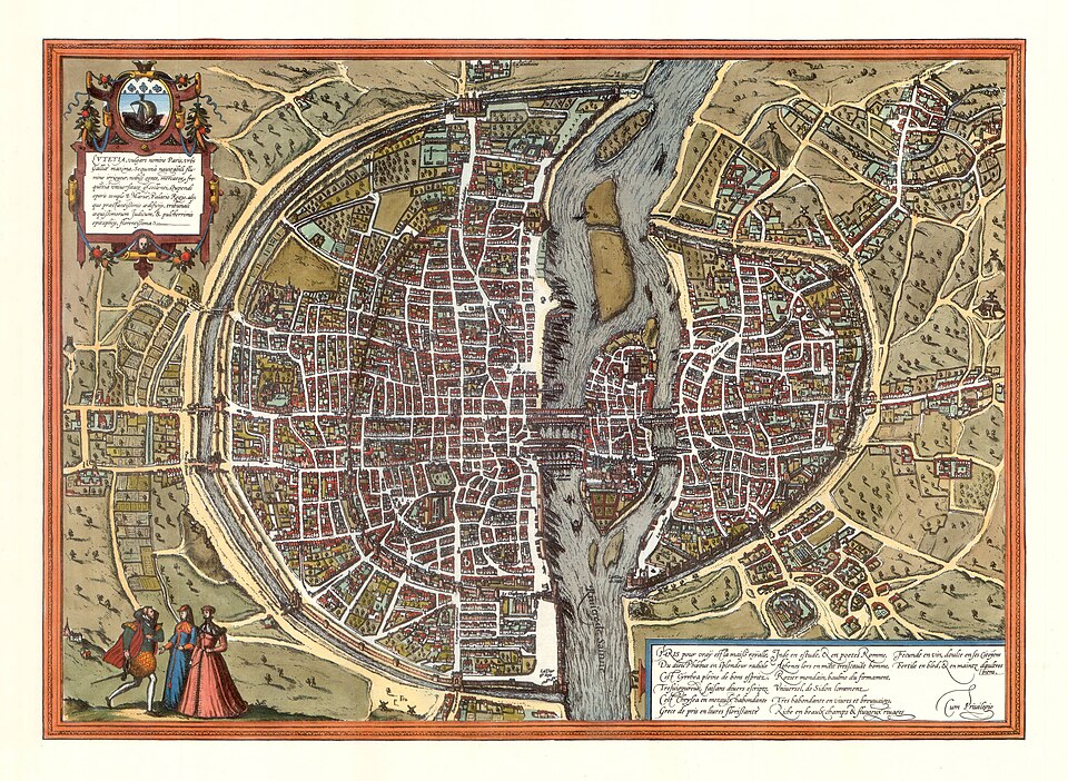
To understand the oldest layers of Paris, start with Lutetia, its Gallo-Roman predecessor. The Île de la Cité and the Seine’s Left Bank were important parts of this early settlement. Maps reconstructing ancient Paris help explain how the river shaped the city’s development.
2. The Turgot map presents a bird’s-eye city
Commissioned in 1734 by Paris official Michel-Étienne Turgot, the Plan de Turgot was published in 1739. Its detailed bird’s-eye perspective makes buildings appear three-dimensional, revealing streets, courtyards and gardens rather than simply marking roads and boundaries.
3. The map’s printing plates survive
The Turgot map was produced using engraved metal plates. Its 21 original printing plates survive in the Louvre’s collection. They preserve the physical craftsmanship behind one of the best-known representations of eighteenth-century Paris.
4. Some Seine islands disappeared as separate landforms
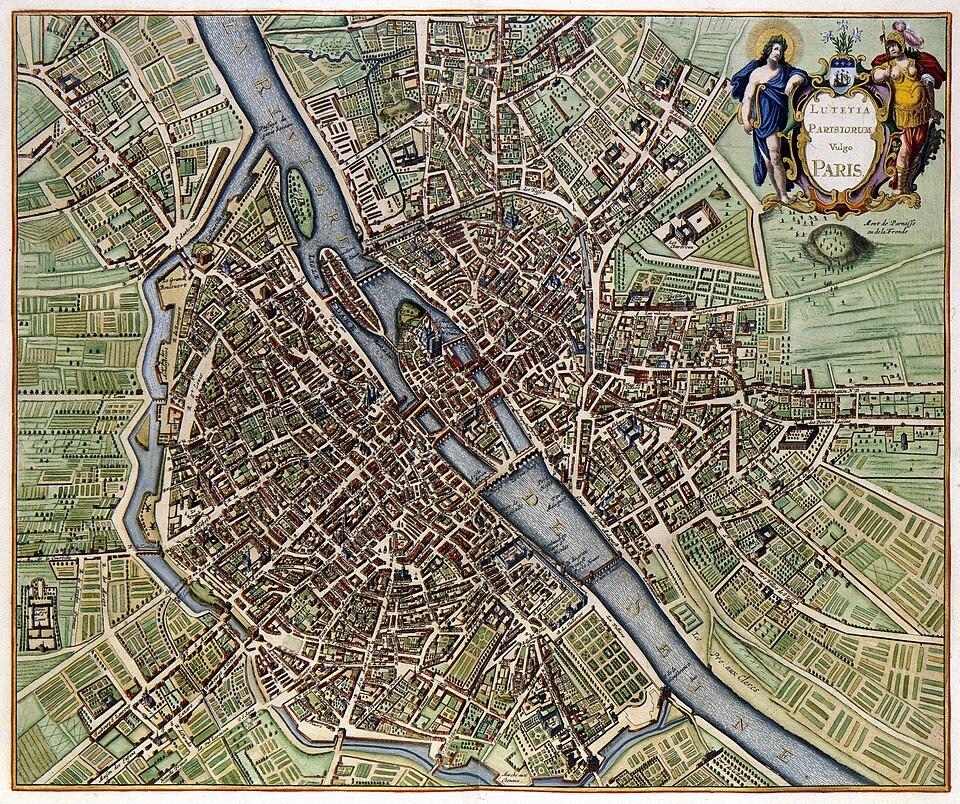
The river’s geography was not always as it appears today. Historical maps record islands such as Île Louviers and Île aux Vaches. As Paris expanded, islands were joined to neighbouring land or incorporated into larger islands, changing both the shoreline and the city’s usable space.
5. Bridges could double as streets of houses
In sixteenth- and seventeenth-century Paris, some bridges supported rows of homes and shops. The Pont Notre-Dame was one example. These crossings were places to live and trade, not merely routes from one bank to the other.
6. Successive walls marked the growing city
Paris expanded beyond a series of defensive boundaries. Two important examples are the medieval Wall of Philip Augustus and the nineteenth-century Thiers Wall. Comparing their positions on maps reveals how much the urban area grew over time.
7. The Pont Neuf broke with bridge-building tradition
Despite its name meaning “New Bridge,” the Pont Neuf is a historic landmark. It opened in 1607 and was the first Parisian bridge designed without houses on its deck. Its open layout offered a striking contrast to the city’s inhabited crossings.
8. Pre-Haussmann Paris had a very different street pattern
Maps made before the 1850s show a dense network of narrow streets, many inherited from the medieval city. Baron Haussmann’s subsequent redevelopment introduced broad boulevards and reshaped major routes through Paris. Comparing maps from before and after these works makes the transformation especially clear.
9. Three areas had distinctive historical roles
A useful way to read historic Paris is through three broad associations, rather than rigid boundaries:
- The Île de la Cité was a centre of administrative authority.
- The Right Bank was strongly associated with commerce.
- The Left Bank was associated with the university and academic life.
10. The Grand Châtelet vanished from the cityscape
The Grand Châtelet was a fortified medieval gatehouse guarding the northern approach to the Île de la Cité. Demolished in the early nineteenth century, it remains visible in historical maps and depictions. Its disappearance is a reminder that familiar modern streets can occupy spaces once dominated by major defensive structures.
Key facts
- Paris developed from the Gallo-Roman settlement known as Lutetia.
- Michel-Étienne Turgot commissioned the Turgot map in 1734; it was published in 1739.
- The Pont Neuf opened in 1607 and was designed without houses on its deck.
- The Seine once had separate islands that were later joined to other islands or the riverbank.
- Maps made before the 1850s show Paris before Haussmann’s large-scale street transformations.
Test your knowledge
Ready to quiz yourself on History & Heritage? Take the quiz now!
Start Quiz →Published by WizdomMaster · Educational content for quiz enthusiasts